Pamir: exploring the ‘roof of the world’ in remote Tajikistan
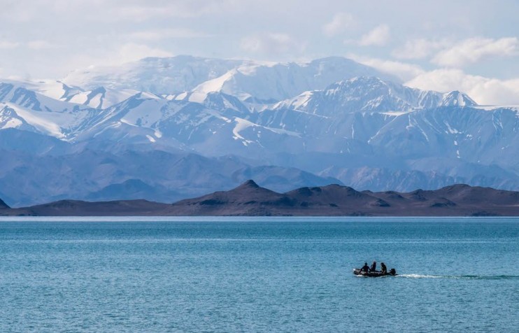
Image: Josh Nadeau
The Pamir — a range of mountains and high-altitude plateaus that stretches through Tajikistan to Kyrgyzstan and Afghanistan — offers visitors uncompromising terrain, stunning views, unmatched hospitality and distinctive religious traditions. Find out how to get around the New East’s most remote outposts
15 January 2018
Text
Josh Nadeau
A range of mountains and high-altitude plateaus forming roughly half of modern-day Tajikistan, the Pamir entered into the Russian Empire at the end of the 19th century, before joining much of Central Asia within the Soviet Union. Since the collapse of the USSR, the previously inaccessible Pamir has gradually emerged as a major draw for anyone looking to encounter the most remote and rewarding outposts of the New East.
The Pamir owes much of its cultural richness to having sat on the periphery of empires. Today bordering Afghanistan, China, Kyrgyzstan and Tajikistan proper, it has marked the rotating boundaries of various Russian, Mongol, British, Persian, Chinese and Turkic domains. This geopolitical ambiguity asserts itself in the diversity of the Pamiri people — though they account for less than three per cent of Tajikistan’s population (135,000 in 2010), they express themselves in a strikingly broad range of cultures and languages, often named for particular valleys or tributaries of the Panj river.
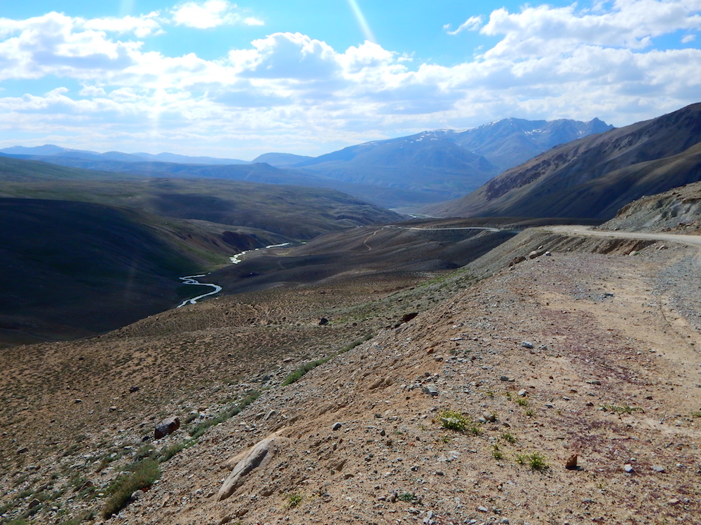
Image: Josh Nadeau

Image: Josh Nadeau
Image: Josh Nadeau
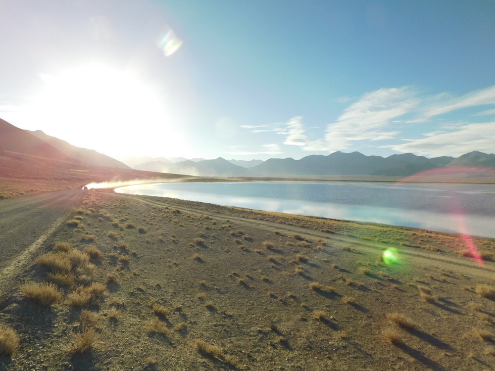
Image: Josh Nadeau
Image: Josh Nadeau
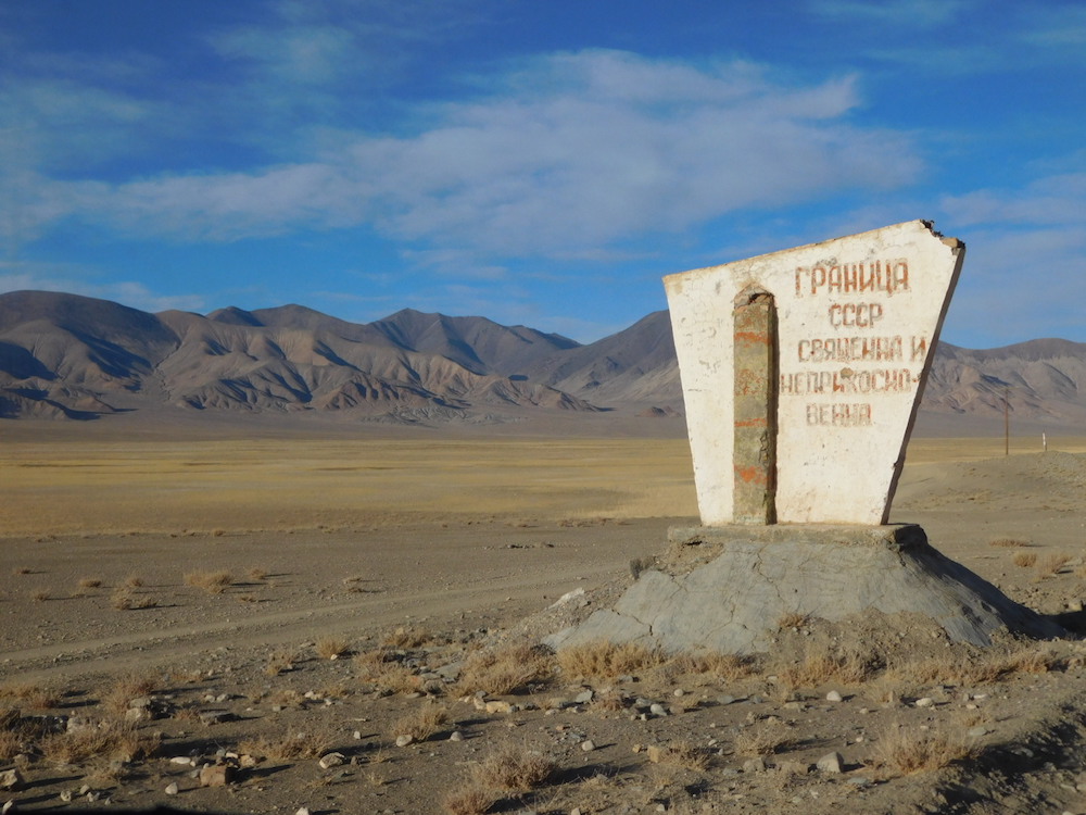
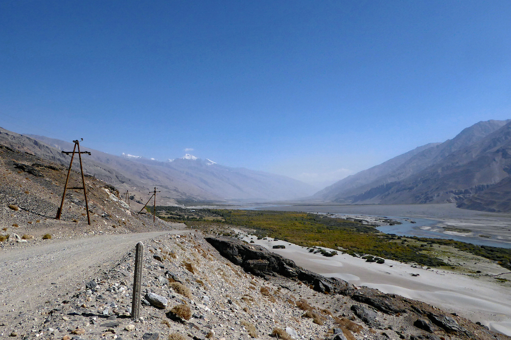
A sign marks the former Soviet border. Image: Josh Nadeau
Victorian explorers were the first to dub the Pamir the “Roof of the World” — its mountains and plateaus form a tectonic knot spreading across Asia through Afghanistan’s Hindu Kush, Kyrgyzstan’s Tian Shan range, China’s Kunlun as well as the Himalayas themselves. The stark and often impassable landscape preserved each valley’s distinct cultural identity; while regional isolation complicates questions of national identity, at the same time it allowed (and allows) locals more leeway to live distinct lives far from the centre of power.
Combined, these factors mean the Pamir has something for everyone. Cultural enthusiasts are free to take in histories spanning millennia, and alpinists have no shortage of treks or challenging passes. Those interested in Islamic life will find locals eager to discuss the uniqueness of the Isma’ili tradition, while adventurous backpackers can revel in exploring the nooks and crannies of one of the planet’s last truly unexplored gems. But since the region’s richness is matched by its obscurity (and lack of infrastructure), it can be hard to know where to start.
Their geopolitical ambiguity asserts itself in the diversity of the Pamiri people, who express themselves in a strikingly broad range of cultures and languages
Luckily, changes in visa policy over the past few years have made Tajikistan, as well as Central Asia as a whole, more accessible for travellers hailing from most parts of the world. Caravanistan, one of the more comprehensive English-language resources for moving around the region, posts regular updates and keeps track of any shifting requirements. An additional permit, itself a relic from the region’s complicated past, is necessary to enter the Pamir (officially the Gorno-Badakhshan Autonomous Region, or GBAO) and can easily be obtained in Dushanbe.
Flying into Dushanbe, the Tajik capital, is the usual point of entry for getting to the Pamir and is worth seeing on its own. It’s also wise to load up on supplies in town as it gets trickier to find specialty items or medication further east. Since the Pamir highway alone can reach altitudes higher than 4,000 metres, tablets for potential altitude sickness are a sensible investment, as well as anything needed to adjust one’s body to local water sources.
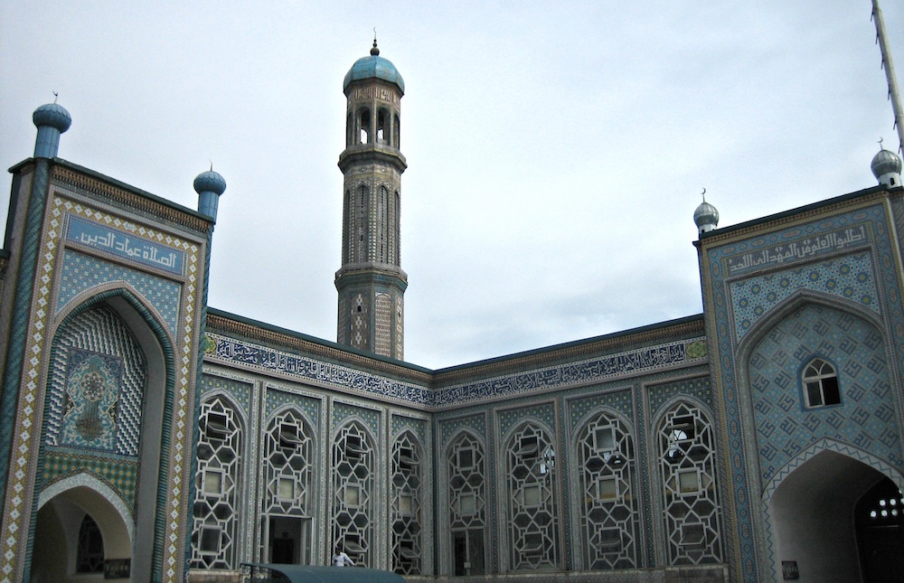
Dushanbe’s central mosque. Image: Prince Roy under a CC licence
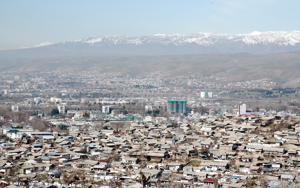
Dushanbe. Image: VargaA under a CC licence
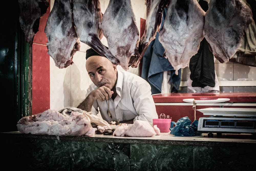
A butcher in Dushanbe’s central market. Image: Ronan Shenhav under a CC licence
The Panj River runs alongside the road outside of Dushanbe. Image: Hans Birger Nilsen under a CC licence
It’s possible to take a flight from Dushanbe to the GBAO capital Khorog (leaving once a day for $85, not so much over the mountains as through them), yet the more common way is to go overland. Hiring a car is possible, but if travelling for the first time it’s advisable to find a driver at the bazaar (from $40-60) — they leave several times a day (the earlier, the better) but only as each vehicle fills up. Finding a good vehicle and driver is key: even though the 600-kilometre stretch might not seem terribly far, road conditions vary wildly and the drive can take anywhere between 14 hours and two days.
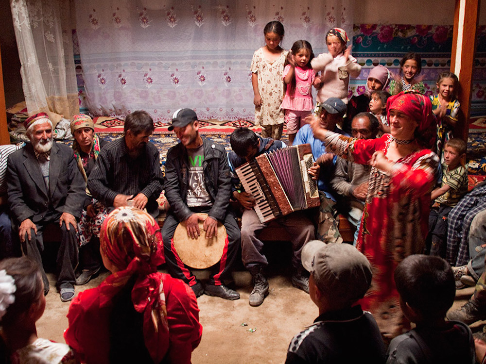
The route is not for the faint of heart. One’s van might be crowded, temperatures in summer are high and, for some patches of highway, even the notion of pavement becomes somewhat relative. But, once past the initial GBAO checkpoint, the atmosphere begins to shift. Drinkable streams skip over rock faces and everyone stops to fill their bottles. People compare trips and laugh over tea and shared bread. Someone ropes a surprisingly-passive goat to the top of the van. Nearby hitchhikers are invited to weddings, or at least home for the night. Children crawl over you to get back to their seats.
People compare trips and laugh over tea and shared bread. Someone ropes a surprisingly-passive goat to the top of the van. Hitchhikers are invited to weddings, or at least home for the night
Along the way to Khorog people point out the different valleys. Vanj, the first major river gorge, is followed by Rushan and Bartang. From here one can cross through the interior to lakes like Karakol or, with an additional (and easily obtainable) permit, Sarez. The latter was formed by an earthquake in 1911 — given seismic instability in the region, it’s feared that another quake could break open Sarez’s natural dams and jump-start a flood that could reach as far as Uzbekistan.
All these rivers flow into the Panj (which eventually empties into the Amu Darya, the famous Oxus of antiquity), which serves both as natural guide for the highway and as the border with Afghanistan. Khorog itself sits at the confluence of the Gunt river, forming a small delta that feels, especially after the long journey, not entirely unlike an oasis. As the traditional meeting point of the upper and lower Pamir, as well as the intersection of roads heading from Dushanbe to China, or from Afghanistan to Kyrgyzstan, its markets are stocked with nuts, dry fruit and goods hard to find anywhere else. The city, famous for its poplars, stands in vibrant and green contrast to nearby peaks.
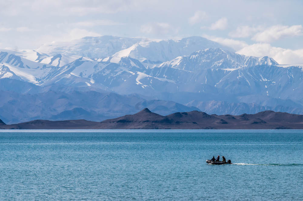
Lake Karakol. Image: Ronan Shenhav under a CC licence
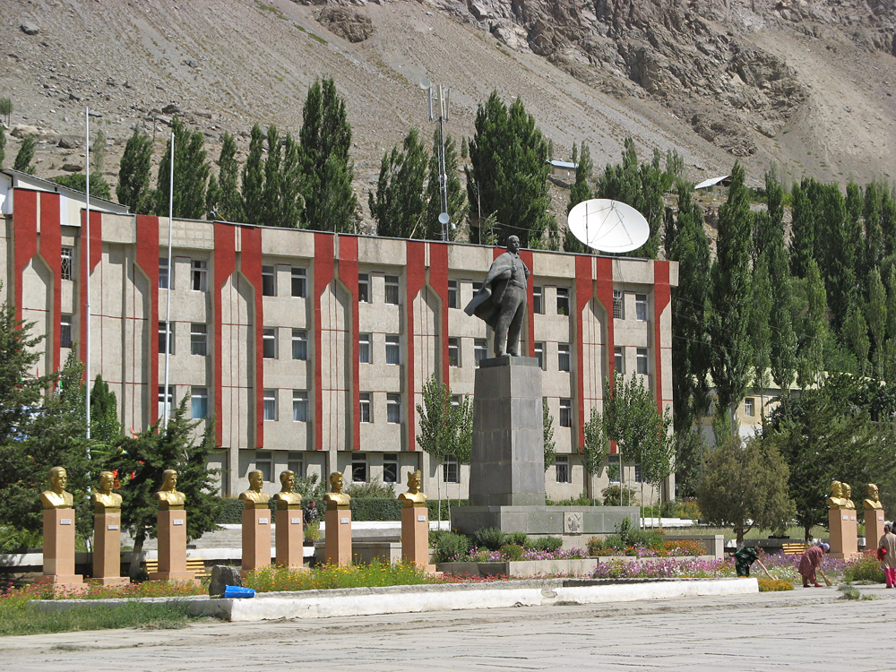
Khorog. Image: kudinov_dm under a CC licence
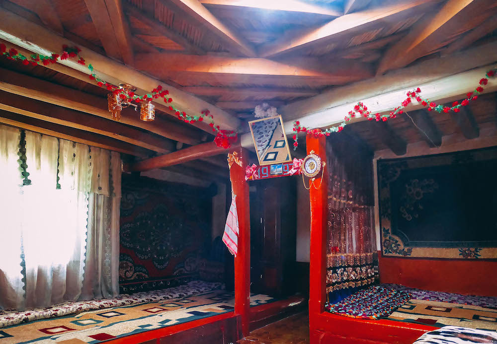
Inside a Pamir house in Khorog. Image: Kalpak Travel under a CC licence
A traditional Pamir wedding party. Image: Evgeni Zotov under a CC licence
With Afghanistan just across the river, questions naturally arise about the region’s security, and these are only compounded when Tajikistan’s civil war, a violent period that stretched from 1992-97, comes up in conversation. The conflict was brutal, with the GBAO joining other regions against central government in Dushanbe. One consequence, though, was greater autonomy for the region, along with official recognition of its distinct cultural identities, which have more in common with northern Afghanistan than with Tajikistan proper. Traditionally, Badakhshan was a region including both the Pamir and North-West Afghanistan — it was cut in two when the borders of modern-day Afghanistan were created to serve as a buffer zone between Russian Central Asia and British India. In fact, Afghan Badakhshan continues to be the safest region in the nation, with a large stretch of the Hindu Kush mountains shielding it from most of the tensions in Kabul.
Much of the visible development in Khorog, from the spacious Central Park, hillside Botanical Gardens and nearly completed Jamatkhana (a combination of mosque, social centre and education space), are funded by the Aga Khan, the leader of the Isma’ili sect of Shia Islam. A minority in a Sunni country, the Pamiris take great pride in their local religious heritage and treat the Aga Khan (whose portrait is found in most homes) with more respect than even the country’s president.
A minority in a Sunni country, the Pamiris take great pride in their local religious heritage
Pamiri Isma’ilism is unique in a number of ways. The region’s geographical isolation made it difficult for initial Muslim missionaries to break ground, and so compromises were made allowing older religious practices to be incorporated into contemporary worship. Mosques are almost non-existent in the region, with Khorog’s Jamatkhana the first official place of public worship. Many traditions are instead centred around the Pamir House, a traditional residential building that draws on ancient fire-worship as much as contemporary Islam. With a skylight, representing the four elements, descending in concentric layers to the five pillars standing in for the family of the prophet, every aspect of the home carries symbolic weight reflecting Badakhshan’s diverse history. A visit to a Pamir House, often complemented with the gift of traditional woolen socks or a skullcap, is often the highlight of any time spent in the region. While locals will often open their homes and kitchens free of charge, it is acceptable to make a small contribution — the economic situation, even with investments made by both the Aga Khan and Dushanbe, is still harsh. $10 dollars for a night, or $15 with meals is a good benchmark.
From Khorog, one would typically take the road leading up to Murgab and deeper into the upper Pamir interior, but it’s worthwhile to take a detour down the Panj to Ishkashim and along the southern road through Afghanistan’s Wakhan Corridor. Ishkashim often serves as a base to enter Afghanistan, either on a full visa (easily obtainable in Khorog) or without a visa for a few hours at the Saturday border-market. To enter, you must give your passport to the border guard and collect it again on leaving. The Pamiri side has no shortage of compelling sites as well: the Bibi Fatima hot springs lie further east and are believed to improve fertility. Smaller temples dot the highway where, over a millennia ago, fire was used in the worship of Ahura Mazda, the main Zoroastrian deity.
The road from Murgab to Osh in Kyrgyzstan. Image: Paul under a CC licence
Murgab. Image: kvitlauk under a CC licence
Villagers outside Murgab. Image: Paul under a CC licence
The Ak-Baital pass, 4,655 metres above sea level. Image: Hans Birger Nilsen under a CC licence
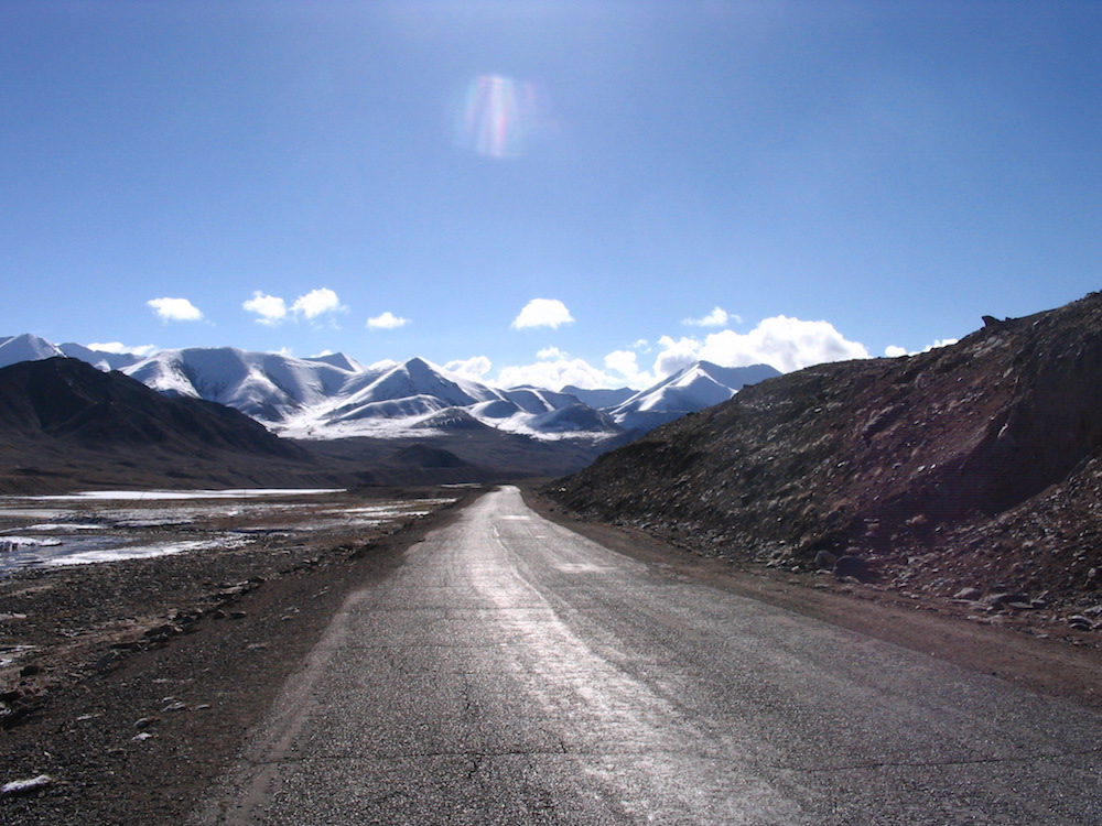
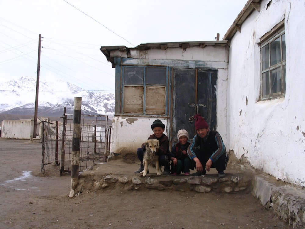
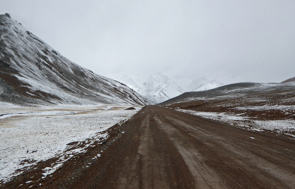
It’s charitable rather than accurate to call the highway leading from Khorog to Murgab and then over the Ak-Baital pass toward Kyrgyzstan a “road”. No buses are allowed in the upper Pamir plateau, and conditions are such that the first truck to make it through now stands as a monument. Driving up through the last stretches of river valley takes you past the treeline, until the only visible flora are scattered, low bushes and scrubby lichen. In its final stretches, the Pamir is peak and desert. Cyclists are seen ascending or descending in late summer, Pamiri villages make way for high-altitude Kyrgyz settlements and the few signs that do exist are covered in personalised decals from two decades of backpackers.
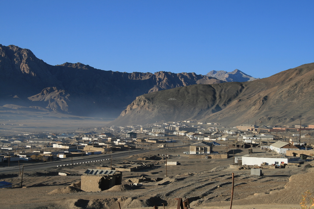
Murgab, the administrative centre of the Pamir plateau, is also the area’s only large settlement. Trips to smaller locales like Rangkul or Karakul are common and can be made by bargaining with local drivers hovering around aging Soviet sedans — spending at least a few days exploring is highly recommended, if only to sit with the impression of loneliness only a stark landscape can provide.
Moving on from Murgab means crossing the Ak-Baital pass, 4,655 metres above sea level. To the left is Karakul, an impact-crater lake ranking among the highest in the world, and to the right the Chinese border. The air is cool even in August and, in winter, border guards can be seen on donkeys hauling supplies between checkpoints covered in snow. Everything’s quiet except the wind and the engine of whatever one drives. Slipping through the last pass before the plunge towards Kyrgyz cities like Sary Tash and Osh, if you look back you’ll catch a last glimpse of the horizon, scattered peaks, and drop-offs navigated by Marco Polo sheep — and it really is like being on the roof of everything. And from there, slopes descend suddenly in every direction at once.